City of Sandy Springs: Sidewalk Project – Glenridge Drive, Mt. Vernon Highway to Abernathy Road
Service Details
Surveying
Route surveying performed in preparation of Base Map for design of sidewalks along Glenridge Drive (3050 l.f.). SEI obtained right of way plans, deeds, plats and other pertinent information for project planning and for future right of way resolution. SEI utilized survey grade GPS units to establish survey control throughout each route for Vertical (MSL) and horizontal control. These control points were confirmed for accuracy by running a level loop on each route. A terrestrial 3D scanner and total station were utilized to gather the data required for the Base Map. These include; topography, creeks, streams or ditches, storm water and sanitary sewer pipes and associated structures, curb, gutter, pavement, striping, traffic control devices, all above ground visible utilities, property corners, right of way markers and any unusual features. Information gathered was then processed and verified for accuracy, imported into CAD format. Analysis on the right of way was performed and resolved. The Base Map was then provided in Microstation format for our Transportation Department to begin conceptual design.
3D Laser Scanning
SEI performed 3D terrestrial laser scanning along Glenridge Drive in Sandy Springs, GA in support of a sidewalk and streetscape project. All utility services including sewer and water were further located by conventional survey methods to include structure depths. Scan data was used to create highly detailed roadway cross-sections and accurate spot elevations for design purposes. Through a combination of conventional survey data and the 3D scans, the existing and proposed underground utilities are being modeled 3 dimensionally and integrated into the design base data. The modeled existing utilities will help prevent unnecessary conflicts during design and construction.
 Transportation Engineering
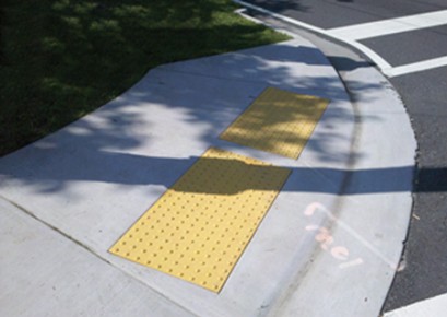
This project also consists of adding or replacing sections of non ADA compliant sidewalks, providing ADA accessibility at intersections and driveways, relocating utilities, limited adding/replacing of curb and gutter, and improving existing drainage facilities along three separate roadway segments throughout the City. Designs are complicated along these segments of roadway due to the narrow right of way, intense vehicular activity, abundant surface and subsurface utilities and multiple driveways. The project will be run according to the GDOT PDP process and a City approved modified PDP process for expediency. Approximately 4100-lf of sidewalk and curb & gutter will be installed along the corridor.

